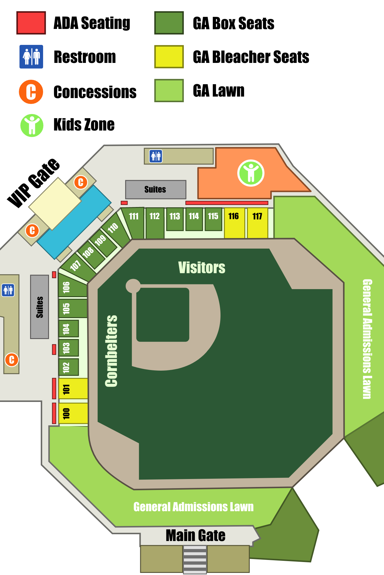
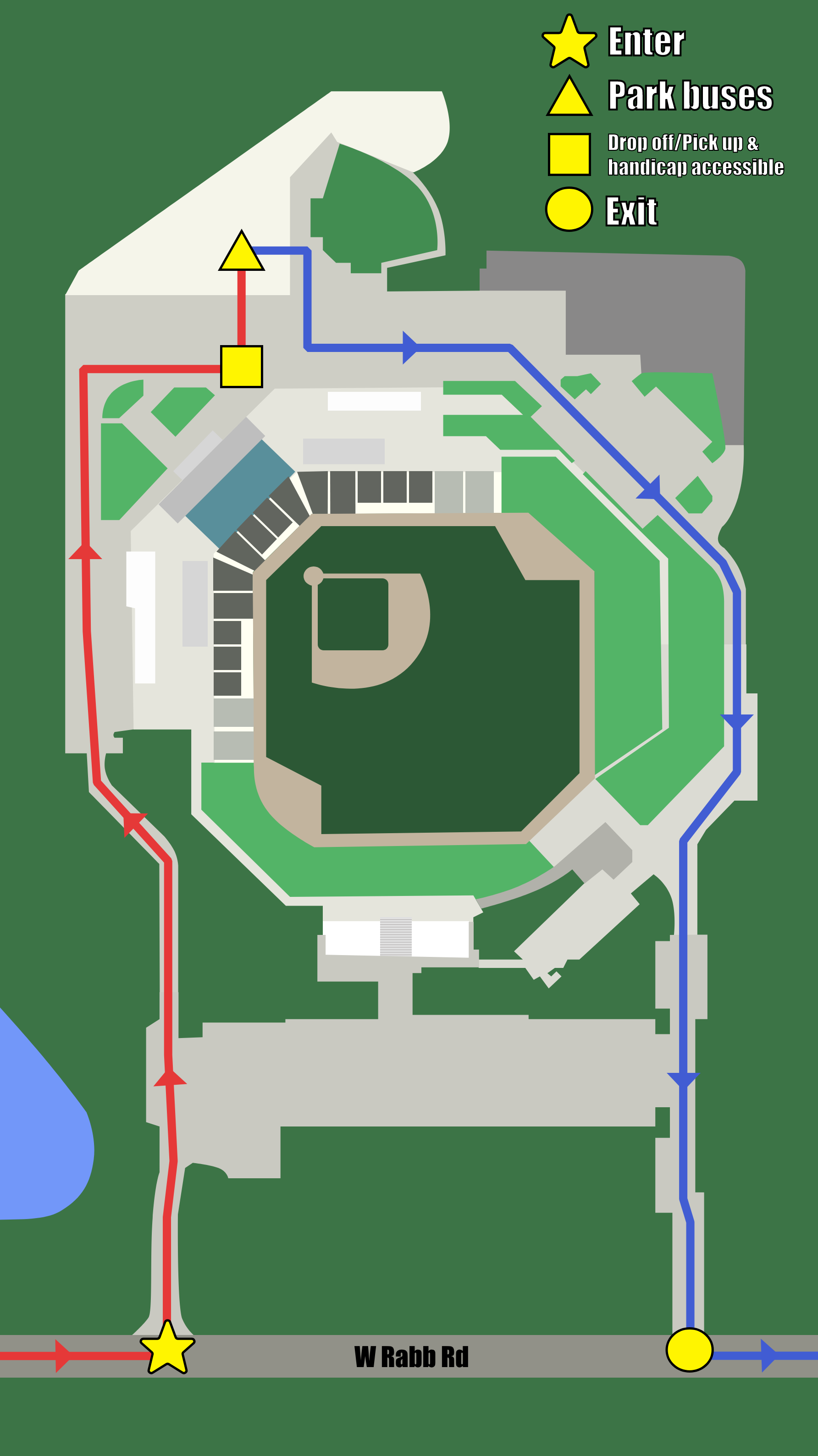
One project I was most unfamiliar with making was creating updated maps of the Corn Crib stadium, since, at this time, they didn’t have an official map other than an overview map from years ago. These would be used to help guests navigate the buildings and seatings, but also could be edited to add directions for specific parking for certain events. The maps I made were in preparation for Education Day. This included parking directions, a version with labeled sections and places of interest, a close-up of the seating with each invited schools’ seating section labeled, and a labeled vendor map. I really appreciate vectors now as constantly re-adjusting the size of the boxes would’ve been frustrating if it kept on losing resolution! I also didn’t know anything about map making so this was a cool and informative experience!